We spent a day exploring the north-western tip of Trinidad. Our early-morning route took us through the outskirts of the island’s capital, Port of Spain. As we were to find out later in our stay, these roads are normally gridlocked, but this early on a Sunday morning, they were pleasingly quiet.
In this article
Our Route
We drove on, past the city, and joined the coast road to Chaguaramas. Despite some guidebook accounts I’ve read to the contrary, it isn’t the most attractive coast. There is very little beach. There are, however, lots of ugly concrete buildings, many of which were built by the US military in the 1940s and which are now used by businesses and government departments.
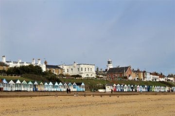
Our drive continued along Williams Bay, a wide cove with a very narrow strip of pebbly beach overhung by a concrete boardwalk. The area was already packed with Trinidadians enjoying the sunshine and swimming in the unappealing muddy water. We weren’t tempted to stop!
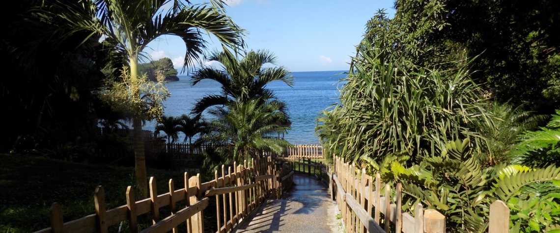
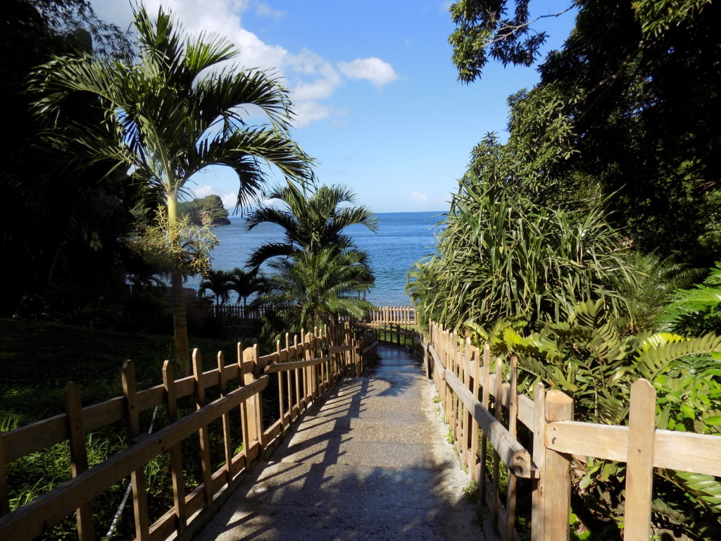
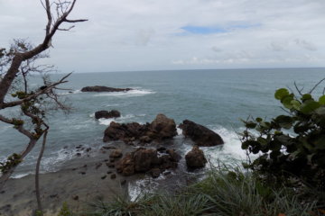
We turned off the coast road to drive through Tucker Valley to Trinidad’s north coast. This area is all national park and is maintained by the Chaguaramas Development Authority. The scenery is certainly lush and beautiful.
Macqueripe Beach
We continued right to the end of the road at Macqueripe Beach. We paid our $20TT to park and went to have a look. Our Rough Guide describes it as ‘a gorgeous spot’. This is somewhat of an overstatement, I feel! The beach, such as it is, is accessed via wooden fenced steps which zig-zag down to a concrete area behind the bay. As we were descending, people were shouting out warnings to us about how slippy the steps were. They were right, and it was no use hanging on to the handrail as this was flimsy, badly fitted and unlikely to support your weight if you fell! The area to either side of the steps is landscaped, but the feeling when you reach the bottom is still of disappointment. The cove itself is quite pretty, though very small. There’s no sand. The narrow strip of pebbles was heaving when we reached it and the sea was a writhing mass of bathers enjoying the cool water. It wasn’t a place where we wanted to linger! I should say, though, that there is a zip-wire adventure park just behind the beach if that’s something that interests you!
Later in our trip, we found one or two lovely beaches, but Trinidad isn’t your stereotypical Caribbean island with plentiful white sandy bays edged with palm trees.
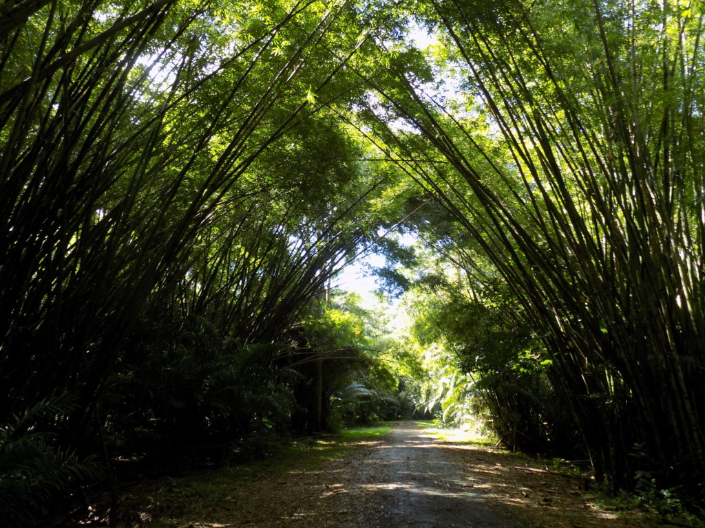
Bamboo Cathedral
We returned to the car and retraced our route back down the Tucker Valley Road, stopping to see the ‘Bamboo Cathedral’. This is a tunnel of giant bamboo which arches over a stretch of tarmac that cars are no longer allowed to drive on. We walked for a while and took some photos, but didn’t go too far as we were planning a two-hour hike to Edith Falls, which we’d read about in our Rough Guide.
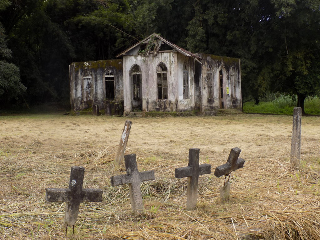
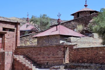
Mount St. Pleasant Village
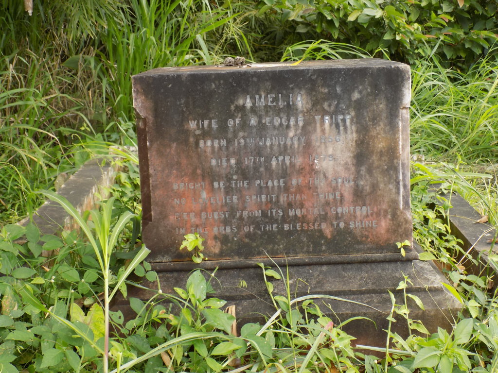
Back at the car, we drove on a little further and stopped at the rather intriguing Mount St. Pleasant village. It’s something of a misnomer as all that’s left of this once thriving settlement is the ruin of St. Chad’s Church and a few haphazard gravestones. During the colonial era, Mount St. Pleasant was part of the Tucker Estate which grew citrus, cocoa and coffee. The village housed the estate workers and their families. Today, little evidence remains of their lives and times. The most striking thing left behind is the rather grand tomb of Amelia Tripp which looks rather out of place in its surroundings. Amelia was the daughter of estate owner, William Tucker, and the wife of Edgar Tripp, the man who installed the first electricity generating plant in Trinidad. She died in 1879 at the age of 23. It is said that her ghost roams the roadway through the Tucker Valley.
The Rest of our Drive
From Mount St. Pleasant we drove up Bellerand Road where we expected to see the turn-off and car park for Edith Falls, as described in our Rough Guide. We didn’t! We passed all the other landmarks described – a children’s play area, a fitness trail, and ended up at the beautifully manicured Chaguaramas Golf Course. The road went no further. We asked a golfer for directions, but he couldn’t help us. Going back the way we’d come, we still didn’t see any sign of Edith Falls. As we rejoined Tucker Valley Road, we asked a policeman. He said there was no car park and he didn’t know how to get to the falls. The falls themselves surely can’t have disappeared, but any information on how to access them certainly had! We were forced to give up. So much for our hike!!
This was to happen to us several times during our stay in Trinidad. The country is rich in oil and gas, and is totally not reliant on tourism. Hence, tourist infrastructure is severely lacking. There is no signage. Tourist attractions are often inexplicably closed. There’s a dearth of public transport to get to places. Above all, there is no exploitation of sites of interest. This was a refreshing change in some ways, but it was ultimately frustrating when we couldn’t even find what we were looking for!
Back on the coast road, we continued through Chaguaramas itself towards the north-western tip of Trinidad. I was expecting more of a town, but it turned out to be a series of disused buildings and a ramshackle collection of houses and small shops.
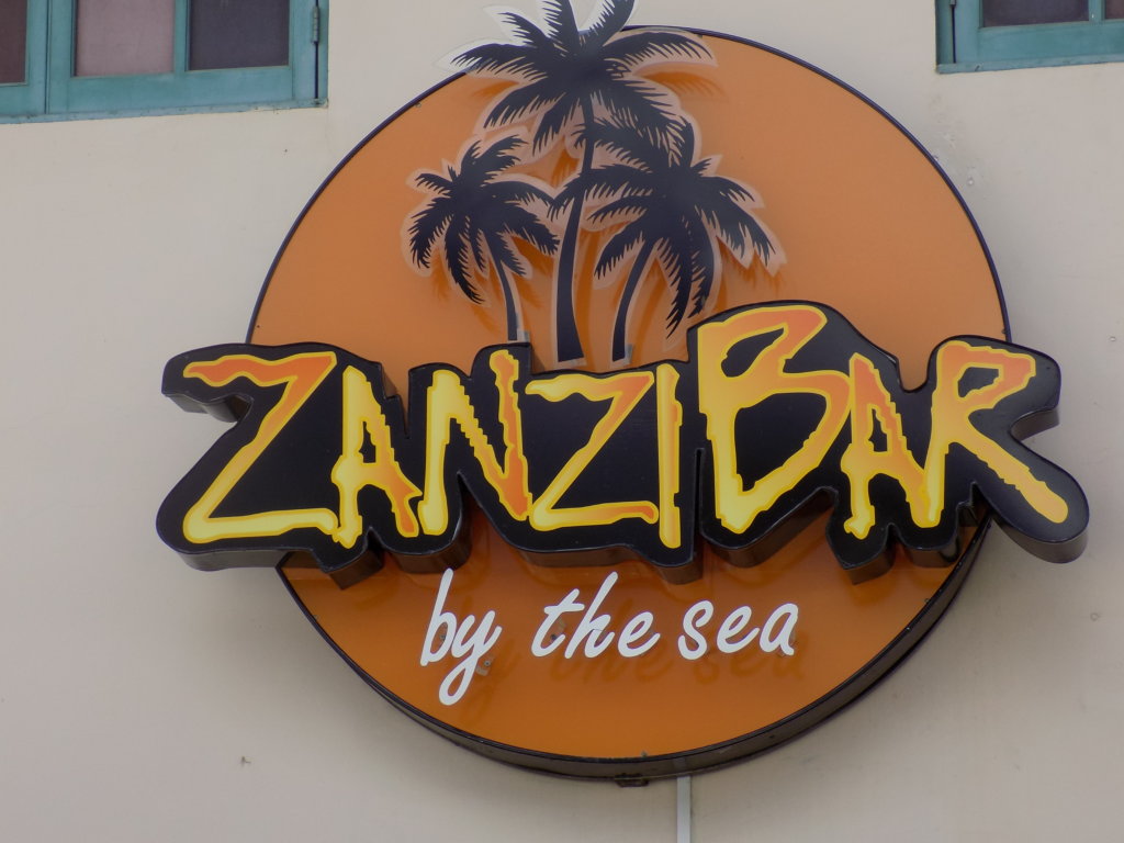
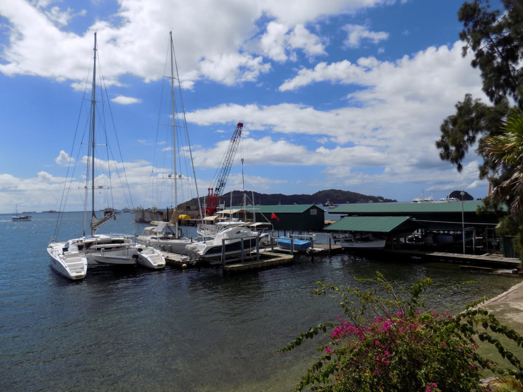
We carried on past several ship-building yards and marinas until we could go no further. It turns out that the extreme tip of the island is a military zone and inaccessible to Joe Public. We turned round and went in search of a restaurant for lunch. There are several recommended restaurants along this coast road, all of them located within boat yards, catering to both ‘yachties’ in the marinas and local business people. You have to pass through security to access them, something which isn’t explained in the guidebooks.
Lunch
We chose Zanzibar by the Sea. It was recommended both by our Airbnb host and our Rough Guide. It is located in Peake’s yacht marina. The restaurant offers indoor and outdoor tables. We chose to sit outside on the deck so that we could enjoy the views of the bay. We had a very pleasant, if expensive, lunch. The portions were huge and, for the first time in my life, I found myself asking for a container to take my peppercorn salmon salad home in. I wasn’t the only one. Plastic boxes were being given out at every table! Much as I hate the use of plastic, I hate to waste food, too! I can report that my meal tasted just as good the following day – and the container is still being used to store bits and pieces!
Read more about Trinidad!
Inspired? Pin it!!
If you’re travelling soon, please use these links!
Are you travelling soon? Use these links when making your bookings. These are the companies we use. It won’t cost you any extra, but we will earn a few pennies to help keep Happy Days Travel Blog going. Thank you!!
- Book your travel insurance with World Nomads (Never leave home without protecting yourself, your trip and your belongings!)
- Book your flight with Skyscanner
- Book your accommodation with Booking.com
- Book a tour with Tour Radar or Intrepid Travel
- Book city tours and activities with Get Your Guide
Disclosure: This post contains affiliate links. If you click through for more information, or to make a purchase, it may result in a small commission coming my way. Please note that there is no extra cost to you associated with this. Thank you so much for supporting my site.
Join our mailing list

Sign up to receive our monthly newsletter. Keep up with what we're doing and be the first to receive special offers and insider tips.


Interesting! The thing with oil/gas & lack of tourist infrastructure is the same in Algeria.
Looking forward to see how it manifests itself in Algeria. As I say, here, you start off thinking it’s quite refreshing, but soon become frustrated!!